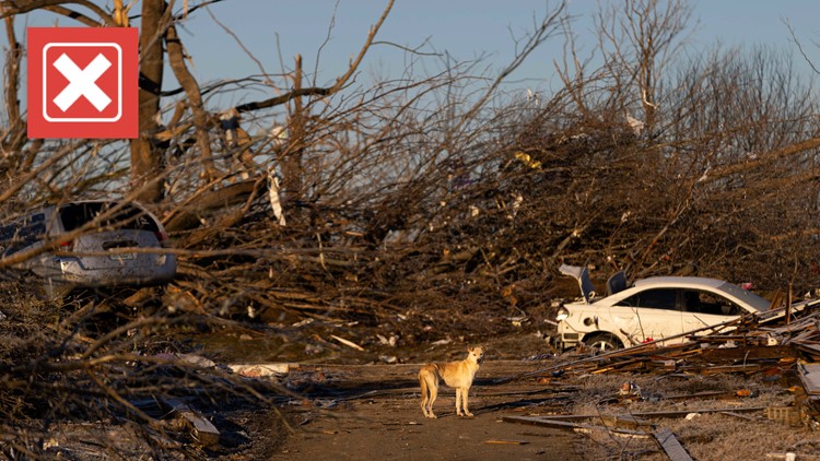
A catastrophic tornado devastated the town of Mayfield, Kentucky on Dec. 10, just after communities in Arkansas, Missouri and Tennessee were also hit by what was believed to be the same tornado.
The tornado was quickly dubbed the “quad-state tornado” in some news reports, as meteorologists believed it could have remained on the ground for over 220 miles across Arkansas, Missouri, Tennessee and Kentucky. Such a path would be the longest in recorded history for a tornado.
Now, new surveys released by the National Weather Service provide insight into those claims.
THE QUESTION
Did the Mayfield, Kentucky tornado have the longest path in recorded history?
THE SOURCES
- National Weather Service (NWS)
- Taylor Kanost, a meteorologist at WOI in Des Moines, Iowa
- Arizona State University
THE ANSWER
No, NWS surveys did not show the Mayfield, Kentucky tornado had the longest path in recorded history. What was initially believed to be one tornado was actually two separate tornadoes.
WHAT WE FOUND
The tornado that hit Mayfield, Kentucky was spawned from a storm system that caused more than 62 tornadoes, according to surveys by the National Weather Service (NWS). It was both the longest and strongest tornado of the outbreak, but its path is only listed at 165 miles long, far shorter than the more than 220 miles the NWS believed the path could be.
That’s because initial surveys from NWS weather forecasting offices (WFOs), released on Dec. 9, found that the 220+ mile long path was actually created by two separate tornadoes: an 80-mile long tornado from Arkansas to Tennessee in NWS Memphis’ forecasting area, and a 165-mile long tornado that touched down just before the Kentucky border in Tennessee and moved across western Kentucky through multiple forecasting areas.
Had they been one tornado, as meteorologists thought they initially could have been, it would have been on the ground far longer than any other tornado in history. The longest tornado in recorded history is the 1925 “Tri-State Tornado,” which tore a path just under 220-miles long through Missouri, Illinois and Indiana, according to official records.
Path length of a tornado can be difficult to determine in part because of the nature of tornadoes: They’re difficult to pick up on radar. Instead, meteorologists use radar to track the mesocyclone, a rotating area inside of a supercell thunderstorm that can create tornadoes.
“The mesocyclone is like the meat of the thunderstorm itself. It's like the heart of the thunderstorm,” said Taylor Kanost, a meteorologist at WOI in Des Moines, Iowa. “In order to turn a mesocyclone into a tornado, you need that mesocyclone to tighten up and then stretch down to the ground.”
These two tornadoes came from the same mesocyclone, which the NWS Weather Prediction Center said was notably long-lived. Several WFOs had to go out to the mesocyclone’s path in their coverage area to determine if it spawned just one tornado or if it spawned multiple tornadoes.
This is a process called tornado surveying, which NWS Paducah gave background on in a graphic posted to Twitter. NWS meteorologists physically drive out to the suspected path — determined by damage, storm reports and the mesocyclone radar data — to investigate damage, take pictures, talk to survivors and plot GPS points. They then determine what was tornado damage and what was straight-line wind damage. When they’ve determined that, they can plot a path.
“If it's straight-line wind damage, all the debris is falling down in one direction, and tornado damage is a little bit more chaotic,” Kanost explained.
On NWS Paducah’s interactive damage survey map, there is a gap of about 14 miles between the two preliminary paths. NWS Memphis called the damage in this gap “sporadic” and said there was a “non-trivial” gap in damage reports. According to NWS Memphis, the first tornado was shrinking in width as it approached the end of its path before eventually dissipating.
While the NWS is confident enough to separate the path into two separate tornadoes for now, its surveys are still ongoing and the paths are subject to change.
“We are continuing to evaluate data from UAS, aircraft, and satellites regarding the storm`s evolution as it moved through Obion County,” NWS Memphis said, referencing the county where the first tornado dissipated and the second tornado began. “If the data from the supplemental sources reveals additional critical information, this statement will be updated.”
Whether the paths stay the same or are updated, the tornado remained on the ground far longer than an ordinary tornado. Few tornadoes track longer than 150 miles, and even fewer have tracked that long since the late 1970s. Before then, “tornado families” of multiple tornadoes were often tracked as one tornado because it can be difficult to record such groups of tornadoes correctly without detailed scientific surveys, the NWS says. Tornadoes were once rated and recorded remotely using newspaper accounts and photos before local WFOs took over surveys.
As a result, many older tornadoes with extremely long tracks likely didn’t remain grounded for as long as official records state. Even the “Tri-State Tornado,” which officially had a track of 219 miles, may have actually been multiple tornadoes. A 2013 study determined that its most likely the longest continuous, unbroken path length for that tornado was either 174 miles long or 151 miles long.
The Kentucky tornado’s path was the longest recorded by the NWS since 1975, around the time tornado surveying methods improved.
More from VERIFY: Yes, it’s rare for a severe tornado outbreak to take place in December


